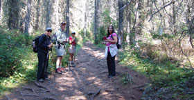
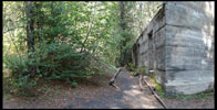
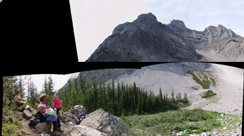
This steep trail takes you part way up Cascade Mountain just outside the town of Banff and ends in a large bowl that has been gouged out of a mountainside by a glacier. Jumbles of rock beside an alpine pond in this cirque make for a good lunch spot. Along the trail you pass the fenced off ventilation shafts from the C-Level coal beds that were part of the Bankhead mining operation until the early 1920's. The return distance is 7.8 km with an elevation gain of 450 m.
 It is at this spot where the mining operations once took place that one can take in views of Lake Minnewanka below. As the trail continues to climb past this spot, hikers will pass several fenced in holes in the ground; these are vent holes from the mine shafts below ground. As you climb you will enjoy views of nearby peaks, such as Mount Rundle, as well as Bow Valley. It is at this spot where the mining operations once took place that one can take in views of Lake Minnewanka below. As the trail continues to climb past this spot, hikers will pass several fenced in holes in the ground; these are vent holes from the mine shafts below ground. As you climb you will enjoy views of nearby peaks, such as Mount Rundle, as well as Bow Valley.
Cirque Peak is located in Banff National Park near Bow Summit approximately 37Km north of Lake Louise. The hike and scramble to Cirque Peak Hike is considered difficult. It is approximately 14.5Km return with a total elevation gain of 1060m. This is one of the easiest high elevation peaks (2993m - 9820ft) that you can summit in Banff National Park. Cirque Peak is also located next to Helen Lake. Park at the Helen Lake trailhead parking lot just before Bow Lake, across from the Crowfoot Glacier viewpoint. The parking lot is small and this trail is very popular, so arriving before 10AM may be necessary. Hike up to the Helen Lake headwall then work your way up the south west ridge of Cirque Peak.  The last 30m before the summit becomes more of a scramble then a hike. Carefully work you way up the rock slabs onto the first summit. The true summit is another 50m to the east with a narrow ridge connecting the two. Be very careful here as the east and south east faces are a cliff to the bottom. Views from the summit are 360 degrees and well worth the effort. To the west you can look down at the Wapta Icefields, Bow Glacier, Bow Lake and Peyto Lake Hike. You're almost eye level with Mount Hector and Dolomite Peak to the south. To the north east, you can see Isabella Lake and the Siffleur Wilderness Area. Dolomite Pass is directly below to the south east. Helen Lake Hike, Caldron Lake, Bow Falls Hike, Bow Lake Lookout, Peyto Lake Hike, Chephren Cirque Lake Hikes, Mount Hector Alpine Climb are all located near here. You are in bear country. The last 30m before the summit becomes more of a scramble then a hike. Carefully work you way up the rock slabs onto the first summit. The true summit is another 50m to the east with a narrow ridge connecting the two. Be very careful here as the east and south east faces are a cliff to the bottom. Views from the summit are 360 degrees and well worth the effort. To the west you can look down at the Wapta Icefields, Bow Glacier, Bow Lake and Peyto Lake Hike. You're almost eye level with Mount Hector and Dolomite Peak to the south. To the north east, you can see Isabella Lake and the Siffleur Wilderness Area. Dolomite Pass is directly below to the south east. Helen Lake Hike, Caldron Lake, Bow Falls Hike, Bow Lake Lookout, Peyto Lake Hike, Chephren Cirque Lake Hikes, Mount Hector Alpine Climb are all located near here. You are in bear country.

Nice shot of Lake Minnewanka, the largest lake in the area, created by man-made dams. An interesting tidbit about the lake: when the 1941 dam was built, it submerged the previous dam, a mountain resort village and more, making this a very popular area for scuba enthusiasts. I can't look at it without thinking of the town beneath all that glacial water.
 
|

